http://chellatgeo.e-monsite.com/pages/sedimentologie.html
Geological department
Faculty of Earth Sciences
University of Constantine 1
Sedimentology
Lessons For L 3
By Smaine CHELLAT
Abstract
Sedimentology is a branch of earth science that focuses on the study of sediments and sedimentary rocks. Sediments are a result of dynamic geological processes that occur at or near the Earth's surface, including weathering, erosion, transport, and deposition. Understanding these dynamic processes is crucial for sedimentologists as they contribute to the formation and preservation of sedimentary rocks, which hold valuable information about Earth's history.
The process of weathering breaks down rocks into smaller fragments, which are known as sediments. This can occur through physical (mechanical) or chemical reactions. Physical weathering involves the disintegration of rocks due to factors like temperature changes and freeze-thaw cycles. Chemical weathering, on the other hand, involves chemical reactions that alter the composition and structure of rocks. These weathering processes contribute to the production of sediments that may vary in size, shape, and mineral content.
Once sediments are generated, they can be transported by various mechanisms, including water, wind, ice, and gravity. The mechanisms of transportation are influenced by factors such as sediment size, texture, and the velocity and strength of the transporting medium. Water, for example, can carry sediments in rivers, streams, or ocean currents, leading to the formation of river channels, deltas, and oceanic deposits. Wind plays a role in transporting fine-grained particles, resulting in the formation of dunes and loess deposits. Glacial ice can transport large amounts of sediment, leading to the creation of characteristic landforms such as moraines and drumlins.
Deposition follows the transportation phase, in which sediments settle and accumulate in different environments. Depositional environments range from marine environments like deltas, beaches, and deep-sea settings, to terrestrial environments like deserts, lakes, and floodplains. The nature of deposition is influenced by factors such as sediment grain size, sorting, and the energy of the depositional environment. The sediments deposited in these environments undergo compaction and cementation over time, leading to the formation of sedimentary rocks.
Studying sedimentology and its dynamic processes provides insights into Earth's geological history. Sedimentary rocks hold evidence of past climatic conditions, environmental changes, and the evolution of life. They also serve as important reservoirs for hydrocarbon exploration and groundwater resources. Moreover, sedimentological studies aid in understanding Earth's surface processes and landform development.
In summary, sedimentology is a multidisciplinary field that investigates the formation, transportation, and deposition of sediments. By studying these dynamic processes, sedimentologists unravel Earth's history and gain valuable insights into the processes shaping our planet. Their findings have significant applications in various fields, including geological exploration, environmental sciences, and paleoclimatology.
Table of contents
Introduction
Continental domain
Aeolian deposits
Glaciers deposits
Torrential deposits
Fluvial deposits
Lake deposits
Cave deposits
Mixed domain
Estuarian deposits
Deltas deposits
Lagoon deposits
Marin deposits
Introduction and subdivision
Littoral deposits
Continental shelf deposits
Types of plate form
Reef deposits and sequences
Continental slope deposits
Turbidite deposits
Abyssal plain deposits
Introduction
The continental domain encompasses vast areas of land on Earth, consisting of diverse landscapes and geological features. Within this domain, various sedimentary deposits can be found, each formed by distinct processes and depositional environments. These deposits provide valuable insights into Earth's history, environmental changes, and the dynamics of land surface processes.
One type of sedimentary deposit found in the continental domain is aeolian deposits, which are formed by the action of wind. Wind carries fine-grained particles, such as sand and silt, and deposits them in landforms such as dunes and loess deposits. These aeolian deposits often provide records of past climate conditions and are common in arid regions.
Glacial deposits, on the other hand, are formed by the movement and erosion of glaciers. As glaciers advance and retreat, they transport and deposit various sizes of sediments, ranging from boulders to fine-grained material. Glacial deposits can be found in regions that have experienced glaciation in the past, including high-latitude areas and mountainous regions.
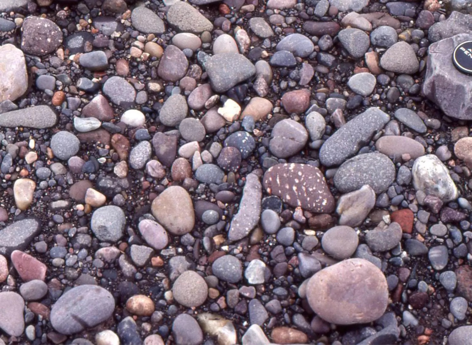
Torrential deposits are another type of sedimentary deposit found in the continental domain. These deposits result from the rapid erosion and transportation of sediments during intense rainfall events or flash floods. They typically exhibit coarse-grained sediments and can be observed in steep slopes, canyons, and river valleys impacted by torrential flows.
Fluvial deposits are formed by the action of rivers and streams. The force of flowing water transports sediments of varying sizes and deposits them in channel beds, floodplains, and deltaic environments. These fluvial deposits serve as evidence of past river activity and are important sources of groundwater resources.
Lake deposits refer to sediments that accumulate in lakes and other lacustrine environments. These deposits vary depending on factors such as water depth, sediment supply, and lake chemistry. Lake sediments often contain information about past climatic conditions, ecological changes, and the history of the surrounding landscape.
Lastly, cave deposits are formed within underground caves and caverns. Minerals precipitate from groundwater and accumulate over time, forming various cave features such as stalactites, stalagmites, and flowstones. Cave deposits can provide valuable records of past climate and environmental conditions.
Understanding the different types of sedimentary deposits found in the continental domain is crucial for deciphering Earth's history and the processes that shape our landscapes. By studying these deposits, geologists and sedimentologists gain insights into past climate change, land surface dynamics, and the interactions between Earth's systems.
Top of Form
Aeolian Deposits and Desertic Sediments: A Comprehensive Understanding
Introduction
Aeolian deposits, also known as eolian or wind-blown deposits, play a significant role in shaping Earth's landscapes, especially in arid and semi-arid regions. Desertic sediments, which are closely associated with aeolian processes, provide valuable insights into past climate conditions, landform evolution, and environmental dynamics. This article aims to provide a comprehensive understanding of aeolian deposits and desertic sediments, exploring their formation, characteristics, and significance in the field of sedimentology and Earth sciences.
Formation and Processes
Aeolian deposits are primarily formed by the processes of erosion, transportation, and deposition of sediment particles by wind. The formation of these deposits relies on specific environmental conditions, including an arid or semi-arid climate, loose and unconsolidated sediments, and a prevailing wind regime. Notably, the wind must have sufficient velocity to mobilize and transport sediment grains. The availability of sediment sources, such as deserts, river valleys, and coastal areas, further contributes to aeolian deposition.
Erosion is the initial stage of aeolian sediment transport. It involves the detachment and lifting of loose sediment particles from the ground surface. The primary mechanisms of erosion include impact of wind turbulence, saltation (hopping movement of particles), and suspension (particles carried within the air mass). Fine-grained sediments, such as silt and clay, are commonly suspended by wind, while coarser particles, such as sand, are transported by saltation.
During transportation, the wind transports sediment grains as bedforms, such as dunes and ripples, across the landscape. Dunes are formed when the wind encounters obstacles, causing the air to flow over and around them, resulting in the deposition of sediment in a characteristic crescent shape. Ripples, on the other hand, are smaller-scale bedforms with wavelengths and heights that vary depending on wind intensity and sediment size.
Deposition occurs when the wind loses its energy or encounters obstacles that hinder its ability to carry sediment further. Depositional environments for aeolian sediments include sand seas, ergs, playa lakes, and interdune areas. Sand seas, characterized by extensive dune fields, are the largest depositional environments for aeolian sediments, covering vast stretches of desert landscapes. Ergs refer to areas dominated by active and stabilized sand dunes. Playa lakes are temporary lakes found in arid regions, where wind-borne sediments settle. Finally, interdune areas are the low-lying regions between dunes, where sediment accumulation occurs.
Characteristics of Aeolian Deposits
Aeolian deposits exhibit distinct characteristics that aid in identification and interpretation. Grain size is a fundamental characteristic, with aeolian sediments typically dominated by sand-sized particles. The sorting of grains tends to be well-controlled, resulting in well-sorted sediments. This is due to the differential settling of finer particles in suspension and the selective transport and deposition of coarser particles.
Cross-bedding is a prominent feature of aeolian deposits, indicating the direction of wind flow during deposition. These inclined layers result from the migration of dunes, with the windward side having a gentle slope and the leeward side having a comparatively steeper slope. This characteristic allows sedimentologists to reconstruct paleowind patterns and infer past climates.
Additionally, aeolian deposits often exhibit a variety of sedimentary structures, including ripple marks, dune forms, and wind-aligned or flute-like marks. These features provide valuable information about depositional environments, wind regimes, and sediment transport dynamics.
Significance of Aeolian Deposits and Desertic Sediments
The study of aeolian deposits and desertic sediments holds significant importance in various fields of scientific research. Paleoclimatology, for instance, relies on these deposits to reconstruct past climate conditions and environmental changes. Variations in grain size, sediment composition, and sedimentary structures can serve as indicators of different climatic regimes, such as aridity and rainfall patterns.
Understanding desertic sediments and aeolian processes is also crucial in studying landform evolution. Dune migration and reactivation provide insights into landscape dynamics, while the interaction between wind and sand affects landforms and ecosystems in arid and semi-arid areas. Investigating the behavior of aeolian sediments contributes to a better understanding of desertification processes, which is particularly relevant in regions impacted by land degradation and climate change.
Moreover, aeolian deposits have economic significance in several industries. Sand dunes, for instance, are sources of construction sand, while some desert regions have potential for the extraction of valuable minerals and resources. Understanding the distribution and characteristics of aeolian deposits aids in resource exploration and exploitation.
Conclusion
Aeolian deposits and desertic sediments are essential components of Earth's continental domain, providing insights into past climates, landform dynamics, and environmental changes. Through erosion, transportation, and deposition, wind shapes the landscape by redistributing sediments and forming characteristic landforms. The identification and interpretation of aeolian deposits contribute to various scientific disciplines, including paleoclimatology, geology, and geomorphology. By studying aeolian processes and desertic sediments, scientists gain a better understanding of Earth's past, present, and future, improving our ability to manage and protect our fragile environments.
Glacier Deposits: Insights into Earth's Glacial History and Landscape Evolution
Introduction
Glacier deposits, also known as glacial sediments, are the result of the erosional, transportational, and depositional processes carried out by glaciers. These deposits provide valuable insights into Earth's glacial history, climate fluctuations, and landform evolution. With their unique characteristics and widespread distribution, glacier deposits play a crucial role in the field of sedimentology and contribute to our understanding of past and present glacial environments.
Formation and Processes
Glacier deposits are formed through the complex interplay of glaciers, ice, and sediment. The process begins with the accumulation and compaction of snow at high elevations, which gradually transforms into glacial ice due to the pressure exerted by subsequent snowfall. As the ice mass gains thickness and moves downslope under the influence of gravity, it acts as a powerful agent of erosion.
Erosion by glaciers occurs primarily through two mechanisms: plucking and abrasion. Plucking involves the freezing and lifting of rock fragments from the underlying bedrock, as the glacier moves over it. Abrasion occurs as the glacier's basal ice, laden with rock debris, scours and polishes the surface it traverses. These processes contribute to the incorporation of various-sized sediment particles into the moving glacial ice.
Transportation of sediment by glaciers can occur in different ways. Supraglacial transportation involves sediments being carried on the surface of the glacier, either within crevasses or deposited directly as debris. Englacial transportation refers to sediments being entrapped within the body of the glacier, moving with the flowing ice. Subglacial transportation occurs when sediments are transported at the base of the glacier, either within or beneath the ice. The transport of sediment by glaciers depends on factors such as ice movement velocity, meltwater production, and basal sliding.
Deposition takes place when the glacier melts or deposits its load of sediment. This can occur due to changes in temperature or the presence of meltwater at the glacier terminus. As the ice melts, the sediments it carries are released and deposited, forming glacier deposits. The depositional environment for these sediments ranges from the terminus of the glacier, where sediment is directly deposited, to adjacent areas affected by glacial meltwater.
Characteristics of Glacier Deposits
Glacier deposits exhibit distinct characteristics that aid in their identification and interpretation. One key characteristic is the presence of till, which is an unsorted mixture of various-sized sediment particles, ranging from clay to boulders. Till is often unstratified and chaotically arranged, reflecting the haphazard deposition of sediment by moving glaciers.
Another noticeable characteristic is the presence of glacial striations and grooves on bedrock surfaces. These features are formed through the abrasive action of the glacier's basal ice, leaving parallel lines and gouges that indicate the direction of ice flow during glacial erosion.
Moraines, both lateral and terminal, are common landforms associated with glacier deposits. Lateral moraines are formed along the sides of a glacier, where debris is transported along the glacier's margins. Terminal moraines are formed when sediment is deposited at the furthest extent of a glacier, marking its terminus at a particular point in time.
Outwash plains and eskers are features associated with glacial meltwater deposition. Outwash plains are formed as meltwater streams carry and deposit sediment in front of or beyond the glacier's terminus. Eskers, on the other hand, are long, winding ridges of sediment that form within or beneath the ice, as meltwater channels get infilled with sediment.
Significance of Glacier Deposits
The study of glacier deposits has immense significance in several scientific and practical domains. First and foremost, glacier deposits provide valuable information about Earth's glacial history and the dynamics of past ice ages. By analyzing sediment characteristics and dating techniques, scientists reconstruct the timing, duration, and extent of past glaciations, enhancing our understanding of climate variability over geological timescales.
Further, glacier deposits contribute to the identification and interpretation of glacial geomorphological features. By mapping landforms like moraines, drumlins, and eskers, researchers can reconstruct the evolution of past glacial landscapes. These findings have practical applications in assessing glacial hazards, such as the potential for glacial lake outburst floods (GLOFs) and the impacts of retreating glaciers on mountainous regions.
Understanding glacier deposits is also vital for exploring and assessing natural resources. Glacial sediments often contain valuable minerals and resources, such as gold, copper, and industrial materials, deposited by glaciers in areas known as glacial placer deposits. Exploring and extracting these resources requires a thorough understanding of glacial depositional processes and the identification of economically viable targets.
Conclusion
Glacier deposits are essential components of Earth's geological history, providing valuable insights into past glacial environments, climate fluctuations, and landscape evolution. The processes of erosion, transportation, and deposition by glaciers help shape our understanding of Earth's glacial past. The distinct characteristics of glacier deposits, such as tills, moraines, and striations, facilitate their identification and interpretation. Glacier deposits have significant implications for paleoclimate research, glacial hazard assessment, geomorphological studies, and resource exploration. By examining and analyzing these deposits, scientists gain a deeper understanding of Earth's glacial history and the dynamics of our changing planet.
Alluvial Fan Deposits: Understanding the Geomorphology and Sedimentary Processes
Introduction
Alluvial fan deposits are sedimentary landforms that form at the base of mountainous areas or in arid regions. These unique features are a result of the deposition of sediment transported by water as it spreads out from narrow channels onto broader, flatter landscapes. Alluvial fans offer valuable insights into sedimentary processes, bedrock erosion, and the dynamics of erosion, transport, and deposition of materials. This article aims to provide a comprehensive understanding of alluvial fan deposits, exploring their formation, characteristics, and significance in geomorphology and sedimentology.
Formation and Processes
Alluvial fans are formed through the interaction of geomorphic and sedimentary processes. Typically, they occur in regions with steep gradients, where fast-flowing water from mountainous areas enters a lower-gradient plain. The formation of alluvial fans is influenced by factors such as climate, tectonic activity, sediment supply, and base level changes.
The process begins with the erosion of sediment by flowing water in the mountains. Rainfall or snowmelt in the upper reaches of a drainage basin triggers the transport of sediment downstream. As the sediment-laden water reaches the lower-gradient plain, it spreads out in a fan-shaped pattern due to the reduction in slope. The rapid decrease in water velocity causes the sediment to be deposited, leading to the formation of alluvial fan deposits.
Characteristics of Alluvial Fan Deposits
Alluvial fan deposits exhibit distinct characteristics that aid in their identification and interpretation. These features include fan-shaped morphologies, coarsening-upward sediment sequences, and a mixture of sediment sizes.
The fan-shaped morphologies of alluvial fans develop as sediment is transported and deposited in a radial pattern from the mountainous source areas. Alluvial fans commonly have a central axis or apex point where deposition is greatest, with sediments spreading outward toward the fan's periphery. The size and shape of alluvial fans can vary significantly, depending on factors such as the amount of sediment supplied, the slope gradient, and the efficiency of downstream sediment transport.
Alluvial fan deposits often display coarsening-upward sequences, with coarser sediment layers closer to the apex and finer sediment layers farther away. This pattern reflects the process of sediment sorting as water carries and deposits larger grains near its source before finer sediments are transported to areas farther from the fan's apex. The variation in grain size and sedimentary structures within alluvial fan deposits provides valuable information about the dynamics of sediment transport and deposition.
Significance of Alluvial Fan Deposits
Alluvial fan deposits have significant implications in geomorphology, sedimentology, and other scientific disciplines.
Geomorphologically, these deposits provide insights into the tectonic and climatic history of an area. Alluvial fans form and evolve in response to changes in base level, including tect
Fluvial Deposits: Understanding the Dynamic Processes of River Systems
Introduction
Fluvial deposits are sedimentary deposits that accumulate within river systems and their associated landforms. Rivers play a crucial role in shaping the Earth's surface through erosion, transportation, and deposition. Fluvial deposits provide valuable insights into the processes, dynamics, and environmental conditions of river systems. This article aims to provide a comprehensive understanding of fluvial deposits, including their formation, characteristics, and significance in the field of sedimentology and Earth sciences.
Formation and Processes
Fluvial deposits are formed through the complex interaction of erosion, transportation, and deposition within river systems. These processes are driven by the flow of water, which is influenced by factors such as slope, discharge, sediment supply, and channel morphology.
Erosion is the initial stage in the formation of fluvial deposits, where water dislodges and transports sediment from the riverbed and banks. As the river moves, it exerts shear stress on the channel, which can detach sediment particles. The erosive power of water is influenced by its velocity, which is determined by the slope and discharge of the river. The amount and size of sediment eroded will depend on the supply and resistance of the underlying geological materials.
Transportation is the process by which sediment is moved within the river system. Sediment particles are transported in three primary ways: as bed load, suspended load, or dissolved load. Bed load consists of larger and heavier particles that roll, slide, or bounce along the riverbed. Suspended load refers to smaller particles that are carried within the water column. Dissolved load consists of dissolved ions and minerals that are not visible to the naked eye but are transported within the water.
Deposition occurs when the transporting capacity of the river decreases, resulting in sediment settling and being deposited. This can happen due to a decrease in flow velocity, changes in river morphology, or the introduction of a new environment such as a floodplain or delta. The deposition of sediment forms various fluvial landforms, including channel bars, floodplains, levees, and deltas. The type and characteristics of the deposited sediment depend on the size, shape, and sorting of the particles, as well as the energy of the flow.
Characteristics of Fluvial Deposits
Fluvial deposits exhibit distinct characteristics that aid in their identification and interpretation. Grain size is an important characteristic, with fluvial sediments ranging from coarse gravel to fine clay. The size and sorting of grain particles within fluvial deposits are influenced by the energy of the flow. Higher energy flows tend to transport and deposit coarser sediments, while lower energy flows are more likely to transport and deposit finer particles.
Another characteristic of fluvial deposits is sedimentary structures, which reflect the dynamic nature of river systems. Common sedimentary structures include cross-bedding, ripple marks, and mud cracks. Cross-bedding occurs when sediment is deposited at an angle, resulting in inclined layers within the deposit. Ripple marks, both symmetric and asymmetric, are formed by the oscillation of water currents and indicate the direction of flow. Mud cracks are polygonal patterns that form when fine-grained sediments dry and shrink.
Fluvial deposits also show evidence of channel migration and lateral accretion. Channel migration occurs as a river meanders or changes course over time, leaving behind abandoned channels or oxbow lakes. The accretion of sediment on the inside of meander bends, known as point bars, is a common feature within fluvial deposits.
Significance of Fluvial Deposits
Fluvial deposits have significant implications in sedimentology, geomorphology, and paleoenvironmental reconstructions. They provide valuable information about the history and evolution of river systems, as well as the environmental conditions of the past.
The study of fluvial deposits helps in understanding sediment transport and erosion processes within river systems. By examining the characteristics of deposited sediments, researchers can infer the velocity and energy of paleo-flows, which aids in reconstructing past river dynamics. This information is valuable for studying changes in channel morphology and predicting future patterns of sediment movement.
Fluvial deposits also play a crucial role in the interpretation of ancient environments. By analyzing the composition and distribution of sediment, researchers can reconstruct past climatic conditions, river systems, and landscapes. Fluvial deposits are often found in association with other types of sedimentary environments, such as glacial, lacustrine, or marine deposits, providing valuable clues about the interaction between different environments over time.
In addition, fluvial deposits are significant in the context of natural resource exploration and management. The deposition of sediment within river systems contributes to the formation of economically important deposits, such as placer deposits and hydrocarbon reservoirs. Understanding
Lake deposits
Lake deposits are a type of sedimentary rock formation that occur in various lake environments around the world. They provide valuable information about the past climate, geological history, and environmental changes that have occurred over time. In this essay, we will explore the characteristics, formation processes, and significance of lake deposits.
Lake deposits are composed of sediments that accumulate in lake basins. They typically consist of fine-grained materials such as silt, clay, and organic matter, but can also include coarser particles like sand and gravel. These sediments are often transported into lakes by rivers, wind, or glaciers, where they settle and accumulate over time. The composition and texture of lake deposits can vary depending on the geological setting, climate, and surrounding landforms.
The formation of lake deposits is influenced by several factors. One important factor is the hydrological regime of the lake, which determines the sediment transport and deposition processes. In lakes with high sediment input, such as those influenced by large rivers, sedimentation rates are generally high, resulting in thicker and coarser-grained deposits. On the other hand, lakes with low sediment input have lower rates of deposition, leading to thinner and finer-grained deposits.
Another factor that affects the formation of lake deposits is the climate. Changes in temperature and precipitation patterns can influence the amount and type of sediment entering a lake. For example, in regions with a wetter climate, higher rainfall can increase the sediment supply to lakes, leading to thicker and more diverse deposits. In contrast, drier conditions may result in reduced sediment input, resulting in thinner and less diverse deposits.
The geological history of a lake basin also plays a crucial role in the formation of lake deposits. The morphology and geology of the surrounding landforms, such as mountains, plateaus, or valleys, can influence the sediment supply to the lake. For example, tectonic activity can create basins that accumulate sediments over time, leading to the formation of thick and well-preserved lake deposits. Similarly, glacial activity can erode and transport large quantities of sediments, depositing them in lakes as glaciers melt, resulting in distinct layers of sediment in lake deposits.
Lake deposits offer valuable insights into past climate and environmental conditions. By analyzing the composition and properties of sedimentary layers, scientists can reconstruct past climates and infer changes in temperature, precipitation, and hydrological patterns. For example, the presence of certain types of pollen in lake deposits can indicate changes in vegetation and climate over time. Similarly, the abundance of certain microfossils and minerals can provide information about past water quality and environmental conditions.
In addition to climate reconstructions, lake deposits also serve as archives for studying geological events and processes. For instance, the study of lake deposits in regions prone to earthquakes can provide insights into the frequency and intensity of seismic activity. Similarly, the analysis of lake sediments in volcanic areas can shed light on the timing and impacts of volcanic eruptions.
Lake deposits also have practical applications in various fields. They are important sources of freshwater for human consumption, agriculture, and industry. Understanding the sedimentation patterns and properties of lake deposits is essential for managing water resources and ensuring sustainable use of lakes. Furthermore, the study of lake deposits is crucial for groundwater management, as lakes often interact with groundwater systems.
In conclusion, lake deposits are valuable sedimentary rock formations that provide insights into past climates, geological processes, and environmental changes. Their formation is influenced by factors such as hydrology, climate, and geological history. The analysis of lake deposits allows scientists to reconstruct past climates, study geological events, and inform water resource management. As we continue to explore and understand lake deposits, we further our knowledge of Earth's history and improve our ability to predict and mitigate future environmental changes.
Karst/Cave deposits
Karst deposits are a unique type of geological formation that occurs in karst landscapes, characterized by sinkholes, underground drainage systems, and caves. These deposits form as a result of the dissolution of soluble rocks, such as limestone and dolomite, by water over extended periods of time. In this essay, we will explore the characteristics, formation processes, and significance of karst deposits.
Karst landscapes are typically found in areas with abundant carbonate rocks, such as limestone or dolomite. These types of rocks are composed primarily of calcium carbonate, which is easily dissolved by slightly acidic water. Over time, as water percolates through the rock layers, it dissolves and removes the soluble minerals, creating underground channels and voids. This process is known as karstification.
One of the key features of karst landscapes is the presence of karst caves, which are formed by the continuous dissolution of the rock. These caves can vary in size, from small passages to massive underground chambers. The dissolution process is usually facilitated by the presence of fractures and bedding planes within the rock, providing pathways for the water to flow and erode the rock more efficiently.
The dissolved minerals are carried along with the water and eventually deposited within the karst landscape. These deposits, known as karst deposits or speleothems, include various formations such as stalactites, stalagmites, flowstones, and cave pearls. Stalactites hang down from the ceiling of the cave, while stalagmites grow upwards from the cave floor. Flowstones form when water flows down cave walls, leaving behind a mineralized sheet or coating. Cave pearls are small spherical formations formed by the continuous movement of water, depositing layers of minerals around a small nucleus.
The formation of karst deposits is a slow process that occurs over thousands of years. As water seeps into the cave through cracks or openings, it becomes saturated with dissolved minerals. When the water comes into contact with air within the cave, it loses carbon dioxide, causing the minerals to precipitate and gradually accumulate, layer by layer, over time. This slow deposition process results in the growth of various forms of karst deposits.
The composition of karst deposits depends on the minerals present in the soluble rock. In limestone-dominated karst landscapes, calcium carbonate is the primary mineral involved in the formation of speleothems. The deposition of minerals also depends on factors such as the water's temperature, pH, and the flow rate. These factors can influence the rate of dissolution and the crystalline structure of the deposited minerals, resulting in variations in the appearance and composition of karst deposits.
Karst deposits hold great significance in several scientific fields. Firstly, these formations provide valuable records of past environmental conditions, including changes in climate and hydrology. By analyzing the isotopic composition of the minerals within the speleothems, scientists can reconstruct past rainfall patterns, temperature variations, and even the vegetation cover during different time periods.
Furthermore, karst deposits also offer insights into the history of the Earth's surface and geological processes. By studying the growth patterns of stalactites and stalagmites, researchers can assess the rates of cave development and understand the dynamics of water flow within the karst landscape. This information contributes to our understanding of landscape evolution, groundwater recharge, and the formation of cave systems.
Karst deposits also play a crucial role in understanding past human activities. Speleothems can provide chronological markers for archaeological sites located within caves. By dating the growth layers of stalactites and stalagmites, archaeologists can determine the age of artifacts and reconstruct human occupation patterns in the past.
From an economic perspective, karst deposits have significant commercial value. Some speleothems, such as cave pearls and large formations like the Jingdong Cave in China, have aesthetic appeal and are sought after by collectors and tourists. The tourism industry often capitalizes on the unique beauty and scientific value of caves with well-preserved karst deposits.
In conclusion, karst deposits are distinctive geological formations that occur within karst landscapes and caves. These deposits are formed through the dissolution of soluble rocks and subsequent deposition of dissolved minerals. Karst deposits, also known as speleothems, provide valuable insights into past environmental conditions, geological processes, human history, and commercial activities. The study of karst deposits not only deepens our understanding of Earth's history but also contributes to various scientific and economic ventures.
Mixed domain
Estuarian deposits
Estuarine deposits are a unique type of sedimentary formation that occurs in the transition zone between rivers and oceans, called estuaries. These deposits are composed of a variety of sediment types, including sand, silt, clay, and organic matter, and are shaped by both fluvial (river) and marine processes. In this essay, we will explore the characteristics, formation processes, and significance of estuarine deposits.
Estuaries are semi-enclosed coastal areas where freshwater from rivers mixes with saltwater from the ocean. These dynamic environments are influenced by tidal action, river discharge, and wave energy, which contribute to the deposition and erosion of sediments. Estuarine deposits can vary greatly in their composition and texture, depending on factors such as the geology of the surrounding area, river inputs, and tidal dynamics.
One of the primary processes involved in the formation of estuarine deposits is the interaction between riverine and marine sediment discharge. Rivers transport a wide range of sediments, including sand, silt, and clay, from their upstream sources and deliver them into the estuary. The sediments settle within the estuary, forming layers of deposited material.
Tidal action plays a crucial role in estuarine sedimentation. Tides cause a back-and-forth motion of water within the estuary, resulting in the movement of sediments. During high tide, seawater floods into the estuary, carrying marine sediments and redistributing them throughout the system. Conversely, during low tide, the river's freshwater input dominates, leading to the deposition of fluvial sediments. This tidal pumping effect creates a dynamic environment that contributes to the stratification and mixing of sediments within the estuary.
Another significant factor in estuarine sedimentation is the influence of wave energy. Waves can rework and transport sediment within the estuary, reshaping the shoreline and affecting the distribution and thickness of depositional layers. Wave energy is especially prominent in estuaries located in areas exposed to strong coastal currents and storms.
The composition of estuarine deposits can be highly variable and is influenced by both terrestrial and marine sources. In the upper reaches of the estuary, closer to the river mouth, fluvial input dominates, resulting in the deposition of coarser sediments such as sand and gravel. As the estuary transitions towards the coast, the marine influence increases, leading to the deposition of finer-grained sediments, including silt and clay.
Estuarine deposits also contain a significant amount of organic matter derived from terrestrial vegetation and marine organisms. The accumulation of organic matter in estuaries is facilitated by the combination of high nutrient inputs from rivers and the relatively low oxygen levels in the sediment. This organic-rich sediment is an essential component of estuarine ecosystems, providing a habitat for a diverse range of organisms.
Estuarine deposits hold significant scientific and societal importance. Firstly, they serve as valuable archives of past environmental change. By analyzing the sedimentary layers and studying the properties and composition of estuarine deposits, scientists can reconstruct past changes in sea level, climate patterns, and human impacts on the environment.
Estuarine deposits also provide key insights into the geological history and evolution of coastal areas. They can record changes in river dynamics, shoreline positions, and sediment transport processes over time. By studying these deposits, researchers can gain a better understanding of the complex interactions between rivers, oceans, and other coastal processes.
Additionally, estuarine deposits play a crucial role in coastal management and engineering. Understanding the sedimentary processes and patterns within estuaries is essential for effective coastal planning, such as shoreline protection, dredging projects, and habitat restoration. Estuarine deposits also contribute to groundwater management, as they can act as natural filters for water quality and provide important groundwater recharge areas.
In conclusion, estuarine deposits are sedimentary formations that occur in the transition zone between rivers and oceans. They are shaped by a complex interplay of fluvial and marine processes, including riverine inputs, tidal action, and wave energy. Estuarine deposits represent valuable records of past environmental changes and provide important insights into coastal evolution and ecosystem dynamics. The study of estuarine deposits is crucial for understanding Earth's geological history, managing coastal resources, and sustaining the ecological health of estuarine environments.
Delta deposits
Delta deposits are a distinctive type of sedimentary formation that occurs at the mouth of rivers where they meet standing bodies of water, such as oceans, seas, or lakes. Deltas form when the river's flow slows down, causing sediment to settle and accumulate over time. This process leads to the formation of a gradually prograding, fan-shaped landform. In this essay, we will explore the characteristics, formation processes, and significance of delta deposits.
The formation of delta deposits is influenced by a range of factors, including river discharge, sediment supply, wave action, and tidal processes. The amount of sediment carried by the river largely determines the size and rate of delta formation. Rivers with high sediment loads, such as those originating from mountainous regions or areas with extensive erosion, tend to form larger and more prominent deltas. Conversely, rivers with lower sediment loads may form smaller and less developed deltas.
The shape of the delta is also influenced by the balance between fluvial (river) and marine processes. Fluvial processes involve the transport and deposition of sediment by the river, while marine processes, such as wave action and tides, can erode or redistribute the deposited sediment. The interplay of these forces determines the distinctive shape of the delta, which can vary from smooth and gently sloping to more irregular and rugged.
Delta deposits are typically composed of a mixture of sediment types, including sand, silt, clay, and organic matter. The sediment composition can vary depending on the characteristics of the river basin, the geology of the surrounding area, and the wave energy and tidal regimes. Coarser sediment is often found near the river's mouth, while finer sediment, such as silt and clay, tends to be transported further offshore.
The depositional processes within a delta can be divided into three main zones: the upper delta plain, the lower delta plain, and the delta front. The upper delta plain is closest to the river's mouth and consists of relatively coarse sediment, including sand and gravel. As the river flow slows down in this area, sediment is deposited, leading to the formation of natural levees and distributary channels.
Moving further downstream, the lower delta plain is characterized by more fine-grained sediment, such as silt and clay. This area is often subject to periodic flooding events, which distribute sediment across the delta and contribute to the development of extensive floodplain deposits. The lower delta plain is typically flat and can be characterized by extensive marshes and wetlands, which provide important habitats for various plant and animal species.
The delta front is the seaward edge of the delta and represents the transition between the marine and deltaic environments. Sediment is continually transported by waves, currents, and tides in this area, resulting in the formation of subaqueous delta deposits. The sediment here may include coarser materials, such as sand, as well as finer materials, such as silt and clay. The delta front is often subject to erosion and reworking as a result of wave and tidal action.
Delta deposits have significant scientific and societal importance. Firstly, they offer valuable insights into past changes in river systems, sea levels, and sediment transport patterns. By studying the vertical and lateral variations in delta sediment layers, scientists can reconstruct the evolution of river environments, assess the impacts of climate change, and understand the deposition and erosion dynamics of deltaic systems.
Delta deposits also provide vital information for understanding and managing coastal areas. The study of deltaic sediments helps to assess hazards associated with flooding and coastal erosion. The unique composition and structure of delta deposits influence groundwater resources and can provide useful information for groundwater management and sustainable water supply planning.
Moreover, deltaic environments serve as critical habitats for diverse ecosystems and play important roles in natural and human-influenced coastal processes. The deposition of sediment within deltas supports the growth of vegetation, providing ecosystem services such as flood protection, stabilization of shorelines, and carbon sequestration.
In conclusion, delta deposits are significant sedimentary formations that occur at the mouth of rivers where they meet standing bodies of water. They result from the interaction between riverine and marine processes, which lead to the deposition and accumulation of sediment over time. Delta deposits offer valuable insights into past environmental changes, contribute to coastal management practices, and provide important habitats for various species. The study of deltaic sediments plays a crucial role in understanding Earth's geological history, coastal dynamics, and ecosystem functioning.
Lagoon deposits
Lagoon deposits are sedimentary formations that occur in shallow, enclosed coastal areas known as lagoons. These deposits are influenced by a variety of factors, including salinity, evaporation, and the presence of various minerals such as gypsum, calcium, and salt. In this essay, we will explore the characteristics, formation processes, and significance of lagoon deposits in relation to these factors.
Lagoons are typically characterized by calm, brackish or saline water, and are often separated from the open ocean by barrier islands or sandbars. The salinity of lagoon water can greatly impact the type and abundance of sediment deposited within the lagoon system. Lagoons with higher salinity levels tend to have more sparse vegetation and may experience higher rates of evaporation compared to lagoons with lower salinity levels.
The process of evaporation plays a crucial role in lagoon systems and contributes to the formation of unique sediment deposits. As water evaporates from the lagoon surface, the remaining water becomes increasingly saline. With continued evaporation, the concentration of dissolved minerals in the lagoon water, such as calcium and salt, becomes more pronounced. These minerals can then precipitate out of the water and contribute to the formation of specific sedimentary features within the lagoon.
One example of a mineral that commonly precipitates from evaporating lagoon water is gypsum (calcium sulfate). Gypsum deposits often form in lagoons with high evaporation rates and high salinity. As the water evaporates, calcium and sulfate ions combine to form gypsum crystals, which can be found in sediment layers and as individual crystals within the lagoon.
Calcium carbonate is another mineral that is commonly associated with lagoon deposits. In lagoons with lower salinity levels, calcium carbonate can precipitate out of the water and accumulate over time. This can lead to the formation of carbonate-rich deposits, such as limestone or calcareous mud, which can be found within lagoon sediments.
Salt, in the form of sodium chloride, is also frequently found within lagoon deposits. As lagoon water evaporates, the saline concentration increases, eventually reaching a point where salt crystals begin to precipitate. These salt deposits, commonly known as salt flats or salt pans, can form extensive layers within lagoon sediments.
The presence of these minerals within lagoon deposits has significant scientific and economic importance. Firstly, the study of lagoon deposits provides insights into past environmental conditions and can help reconstruct changes in salinity, evaporation rates, and climate patterns. The analysis of gypsum and calcium carbonate deposits, for example, can provide information about the historical salinity levels and climatic variations within a particular lagoon system.
Additionally, lagoon deposits have economic value in some regions. Gypsum, for example, is extensively mined for industrial purposes, including the manufacturing of plaster and gypsum board. Salt deposits found in lagoons can also be economically significant and are sometimes actively harvested for salt production.
Furthermore, lagoon deposits support unique ecosystems and provide habitats for various organisms. The presence of saline conditions and specific mineral compositions within sediments can influence the types of plant and animal species that can thrive in lagoon environments. These ecosystems are often important for fisheries, birdwatching, and recreational activities.
In conclusion, lagoon deposits are sedimentary formations that occur in shallow, enclosed coastal areas known as lagoons. The characteristics and composition of these deposits are influenced by factors such as salinity, evaporation, and the presence of minerals such as gypsum, calcium, and salt. The study of lagoon deposits provides insights into past environmental conditions, offers economic opportunities, and supports unique ecosystems.
Marin domain
Marine deposits refer to the sedimentary formations that occur in the vast and diverse marine environment, including the oceans, seas, and other bodies of saltwater. These deposits provide valuable insights into the geological history and environmental conditions of our planet. Let's explore the introduction and subdivision of the marine domain, as well as various types of marine deposits.
Introduction and Subdivision of the Marine Domain:
The marine domain encompasses the entirety of the world's oceans and seas, representing approximately 71% of the Earth's surface. It is divided into several subdivisions based on depth and distance from the coast. These subdivisions include the littoral zone, continental shelf, continental slope, abyssal plain, and the deep ocean floor.
Littoral Deposits:
The littoral zone, also known as the coastal zone, represents the area between the high and low tide marks. It is subject to constant changes due to wave action, tides, and currents. Littoral deposits consist of a variety of sediment types, including sand, gravel, and shells. The dynamic nature of the littoral zone allows for the development of unique coastal landforms such as beaches, dunes, and tidal flats.
Continental Shelf Deposits:
The continental shelf is the gently sloping underwater extension of the continent, extending from the shoreline to the shelf break, typically around 200 meters in depth. Continental shelf deposits consist of sediments eroded from the landmass and deposited onto the shelf. These deposits can include sand, silt, clay, and organic matter. The continental shelf is an important fishing ground due to the rich nutrients and diverse marine life it supports.
Types of Plate Forms:
Plate forms are shallow, flat areas on the continental shelf where sediment accumulates over time. They can be classified into several types based on their formation processes. Sand plate forms are created by the accumulation of sand transported by waves, tides, and currents. Mud plate forms result from the settling of fine-grained sediments. Gravel plate forms consist of larger particles such as pebbles and gravel, and their formation is influenced by wave energy and current strength.
Reef Deposits and Sequences:
Reef deposits are formed by the accumulation of calcium carbonate produced by corals and other marine organisms. Reefs are found primarily in tropical and subtropical regions and can develop intricate structures known as coral reefs. These deposits record the growth and evolution of reef communities over time, providing valuable information about past environmental conditions and the biodiversity of shallow marine ecosystems. Reef sequences also contain important clues about sea levels, climatic variations, and tectonic activity.
Continental Slope Deposits:
The continental slope is the steeply inclined section of the seabed that connects the continental shelf to the deep ocean floor. Continental slope deposits often consist of a mixture of sediments eroded from the continental shelf, as well as sediment transported by gravity-driven processes. These deposits can include turbidites, slumps, and debris flows, which are associated with the transport and deposition of sediment down the slope.
Turbidite Deposits:
Turbidite deposits are characterized by graded bedding, where layers of sediment become progressively finer towards the top. They are formed by turbidity currents, which are underwater sediment-laden flows that move downslope due to gravity. Turbidity currents occur when loose sediment is triggered to flow by disturbances such as earthquakes or storms. These deposits provide valuable information for understanding past geological events and can serve as indicators of submarine canyon activity and slope stability.
Abyssal Plain Deposits:
The abyssal plain represents the vast, flat region of the ocean floor beyond the continental slope. Abyssal plain deposits are generally fine-grained sediments, including clay, silt, and planktonic remains that settle slowly over time. These deposits accumulate at such a slow rate that they are often undisturbed for thousands or even millions of years. They provide insights into long-term depositional processes, climate variations, and slow sedimentation rates in the deep ocean.
In conclusion, marine deposits encompass a range of sedimentary formations found in the marine domain. Each subdivision of the marine domain, from the littoral zone to the abyssal plain, contributes unique deposits that offer valuable information about Earth's
- Enseignant: Smaine CHELLAT